Russian Ridge & Coal Creek
To see more photos of this park go to: www.LCPhoto.SmugMug.com.
Vital Stats
Getting There1. From the Penisula - Take Page Mill Road into the Santa Cruz Mts. When you reach Highway 35 which way you goes depends on where you want to park. See Map.
2. From the South Bay -Take Saratoga Road into the Santa Cruz Mts. Turn Right at Highway 35. When you reach the intersection of Higway 35, Page Mill Rd and Alpine Rd your direction depends on where you sant to park. See map. |
Description and Map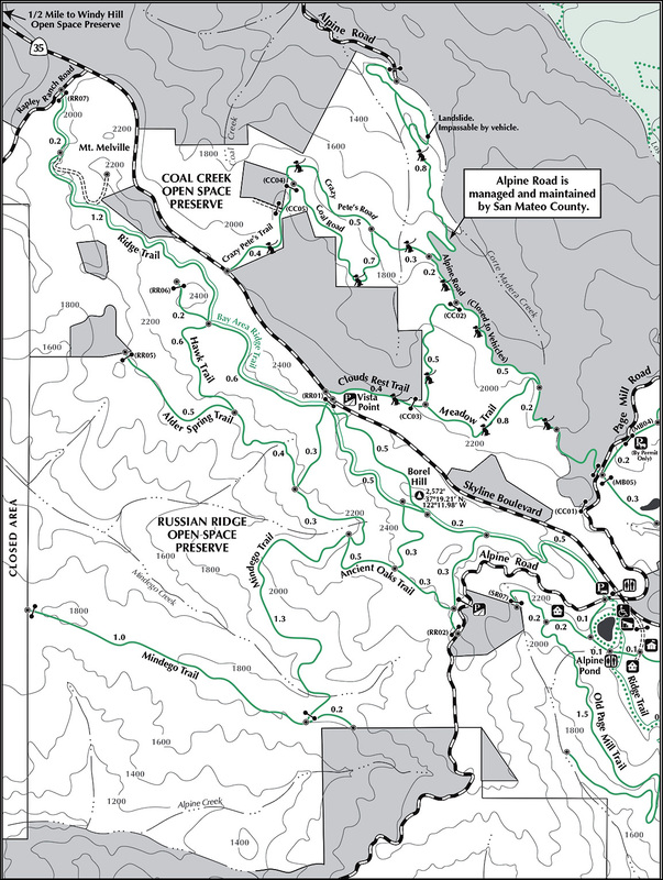
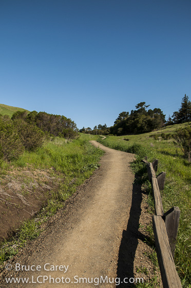
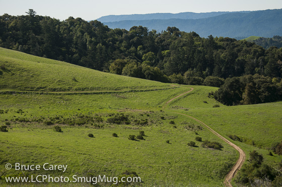
This is a great place for everyone. It's great for those just starting out as the main loop has two cut-offs that allow you to scale your hike to your level. It's also great for intermediate and advanced hikers because the views of both the South Bay Valley on one side and the coast between about Half Moon Bay and Pescadero on the other is tough to beat (many spots give the view of both by simply scanning 360 degrees). Terrain ranges from flat to moderately steep however the steep parts are short, sticking more to longer moderate slopes. Trails range from single lane service road to single track.
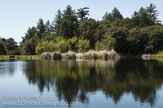
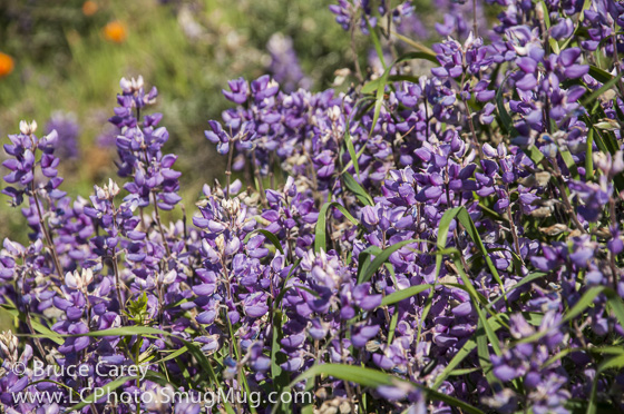
I have read this is a great spot for wildflowers in the spring though so far I've not hit it at the right time or proper conditions to see really spectacular color yet (too early once, no rain the other). The expansive open spaces are breathtaking none-the-less. It's not all open space as sections of the Ancient Oaks Trail have some wonderfully dense moss covered Oaks and even some redwoods thrown in for good measure. Also on the Ancient Oaks Trail, just a short hike the second Alpine Road parking area is a great hillside to watch, or photograph the sun setting over the ocean. An added benefit is the tranquil Alpine Pond just a short walk from the first parking area. A flat half mile loop gets you too and from the lake and even includes a stroll around it's perimeter. If you have some energy left I highly recommend this extension to your hike as it is such a tranquil setting it is a great relaxer for the end to your hike. Links
|
Easiest Hikes
|
Medium Hikes
|
Harder Hikes
|
