Coyote Creek Parkway
To see more photos of this park go to: www.LCPhoto.SmugMug.com.
Vital Stats
Getting ThereThere are multiple access points to this park. See "Park Points" below for directions to each point
|
Description and Map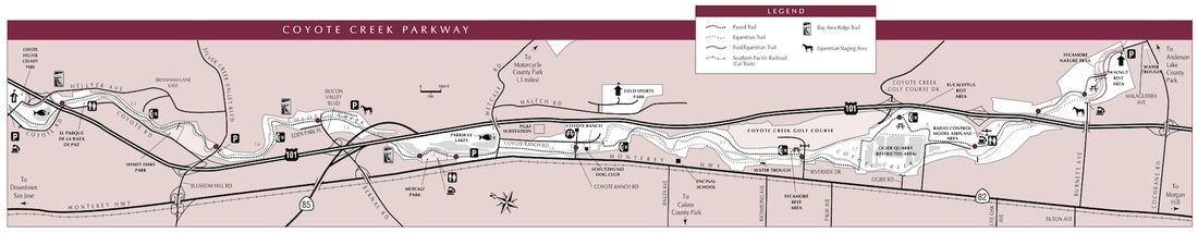
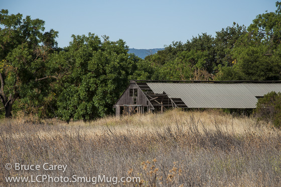
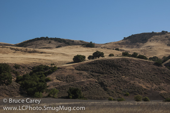
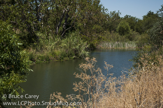
As you can tell from the map, Coyote Creek Parkway is essentially a single long trail. It follows the same corridor as Highway 101 and so you are never far from civilization. However, that doesn't mean that there isn't great scenery. The trail also parallels Coyote Creek which changes from stream to lake and back throughout it's length. And, given the long length of the trail, it passes through a wide variety of ecosystems. Of course grasslands abound, but there are also Oak, Sycamore and even some Eucalyptus groves. The stream and lakes provide havens for many species of birds including Heron, Ducks and Seagulls and Finches are a constant source of action in the scrub around the trail.
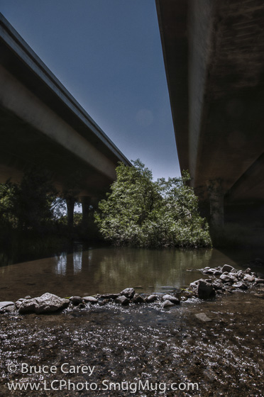
There are also quite a few "human related" sights. As the trail does cross paths with the freeway several times, there are some great underside views of the Freeway overpasses (an interesting perspective we don't often see). There is also a flying field for the local Model Airplane club where you can take a break and watch people fly their wares. Around the first part of July there is usually an air show that I accidentally stumbled onto on one of my hikes in the park and it was actually a lot of fun. For more info on this go to the Santa Clara Model Aircraft Skypark website. Since this trail is just one flat 15 mile stretch it's a great place for those of you who are just starting out. It's easy to customize your walk on the fly, just start walking and when you feel "half tired" turn around and head back. And for all you advanced hikers it's a great spot for a quick walk (or a long one on those days when you want a workout but just don't feel like climbing Mt. Everest!). Given the layout for this park I'm going to diverge from the usual approach of posting suggested hikes. Instead I'm simply going to list all the park points with some general directions to each point and a brief description of the "points of interest" in the vicinity (I'm doing the descriptions from memory initially and will update details as I hike the areas again in the future). Since I have no idea which direction any of you will be coming from directions will be pretty general. I'll give directions from nearby main intersections and leave it to you to get to the main intersections. Below the list is a slide show of photos I've taken along the entire trail starting at Heller Park and heading south. Links |
Park Points
Listed in order from the north end of the park to the southern most point.
1. Hellyer Park
|
Directions
|
Points of Interest
|
2. Silver Creek Valley Rd.
|
Directions
|
Points of Interest
At this point you can head either north or south on the trail. Turning right takes you north to Hellyer Park (see description in section 1 above). This is the description for turning left and heading south.
|
3. Silicon Valley Blvd
|
Directions
|
Points of Interest
At this point you can head either north or south on the trail. Turning right takes you North to the Silver Creek Valley Rd parking area (see description in section 2 above). This description is for turning left and heading south.
|
4. Metcalf Park
Slide show of the entire length of the trail starting at Hellyer Park and heading south. Hover cursor over picture and click the play button to start the show.
