Serpentine - Bald Peaks Loop
To see more photos from this hike go to: www.LCPhoto.SmugMug.com.
Hike Stats
Getting There
Turn-By-Turn
DownloadsRelated Hikes
|
Description and Map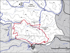
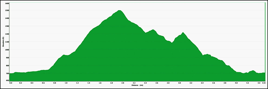
This is a challenging hike not so much for its distance but for the amount of ascent and descent. Some of the steeper sections of this trail are in the 15 to 17 % range. These steep sections are broken up by "milder" 8 to 12% sections.
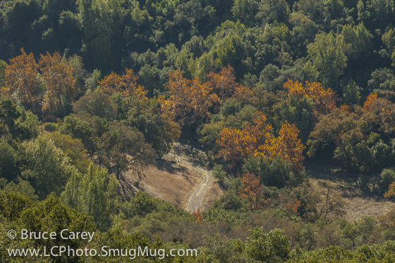
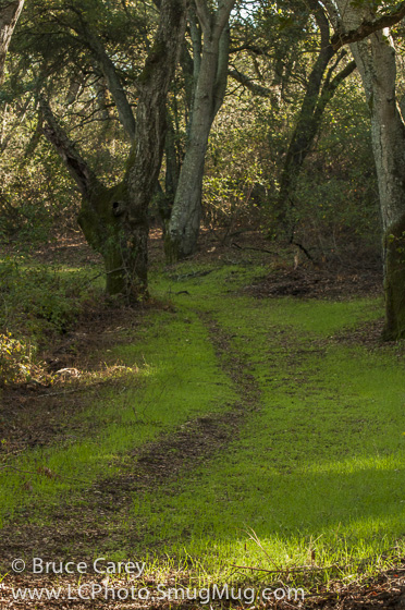
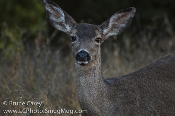
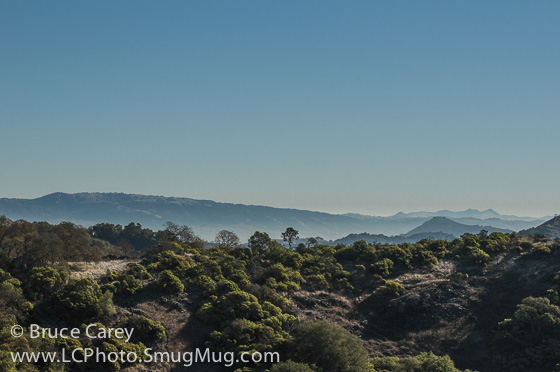
The trail starts as a service road width path and remains that way for much of the time. Here the trail travels along the floor of a narrow, beautiful valley. It follows a creek of unknown name, dry during the Summer and Fall seasons. You are surrounded by sections of open grassland, Oaks, Bayberry, and even a few Maples. Every time I hike this section of trail it reminds me of the stereotypical country road. I pretty regularly spot Deer grazing beside the trail in this section so keep your eyes open and your camera ready! Though the data shows it to be a moderate incline it is so slight as to be imperceptible. That perception is changed after about ¾ of a mile as the trail bears off to the right and up into the hills. Still on the Serpentine Trail you start a long 1.2 mile ascent. There are some steep sections in this long ascent so take a break occasionally to admire the ever expanding view of the valley and surrounding hills. The trail follows a ravine cut by an unknown named tributary of the previous unknown creek for a short way. The Maples disappear and yield to mostly Oak and a sprinkling of Bayberry. As you ascend the Oaks get fewer and further between with larger patches of grass land eventually leading to some scrub sections. As you ascend the Valley views expand to include several rows of the Coastal Range of mountains to the south of the San Jose which, with the usual "California Haze", creates a great layered look. The valley views display a wide variety of textures and shades of green and even some brilliant yellows and oranges in the fall. On reaching the summit of the climb, at the junction of the Bald Peak Trail, stop for a moment to take in the expansive 270 degree panorama extending from Highway 101 near the northern borders of the Morgan Hill area, through multiple layers of the Coastal Range, views of the neighboring Santa Cruz Mts and, if you step off the trail just a bit, a great view down into the valley you just came from. There are some great looks at the trail that you just traversed that make you appreciate the steepness of it! Since there is very little rest for the weary on this hike the Bald Peaks Trail immediately starts to descend. On this section of trail you may catch a glimpse between the trees of downtown San Jose off to the left. Again as the trail descends the vegetation changes from Oaks and some scrub back to alternating between shady Oak covered areas and open grasslands. Turning on to the Canada del Oro Trail the trail narrows to a wide single track. Here the trail starts a fairly steep descent into a denser forested area with Oaks, Bayberry, Elm (?) and even an occasional Manzanita. Berry bushes cover large areas of the forest floor. This section of trail is markedly different than any of the vegetation seen on the rest of this hike so, for those who like variety, it is a welcome respite. As we turn onto the Canada del Oro cut-off things open back into the same Scrub and Oak although one section does skirt a steep ravine with some great colors and texture. In the more densely forested sections I have even spotted a few ferns. Turning back onto the Bald Peak Trail (or maybe it's Serpentine Loop, markings and maps are a bit unclear on this but don't worry it doesn't really matter as eventually the trail does become the Serpentine Loop) the vegetation is Scrub and Oaks. Soon a number of Manzanita's begin to dot the trailsides and become fairly thick at time. The red peeing bark of these trees provide a nice red contrast. Valley views again predominate as we head back into the valley. After a while the trail narrows to a single track that winds through semi dense Oak and Manzanita. The Manzanita's peter out to be replaced by Bayberry as the trail continues its descent into the valley. After a series of switchbacks the trail reaches the bottom of the ravine. From here it's a moderate descent back to the parking area. The trail eventually begins to parallel Casa Loma Rd on the left (the road you took to get here). Still a single track, the trail heads through alternating open grasslands and Oak, Bayberry and Maple forests, crosses a small wooden bridge and eventually returns you to your starting point. Alternate Route Turn Points and Descriptions5.* An alternate is to continue Straight on Bald Peaks Trail. It is only .2 miles shorter (that's 2 tenths of a mile) but eliminates the fairly steep decline and returning incline of the original route. While this alternate is still scenic, it's pretty much the same scenery as the rest of the hike while the original route is unique from what you'll see on the rest of this hike. If you take this option just stay on the main trail past the Canada del Oro Cut-off Trail and pick up at direction #8.
|
Elevation Profile