Seven Springs Loop
To see more photos from this hike go to: www.LCPhoto.SmugMug.com.
Hike Stats
Getting There
Turn-By-Turn
DownloadsRelated Hikes
|
Description and Map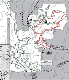
A segment of the longer Perimeter Hike tailored for those beginner hikers ready to step up to a more advanced beginning hike. You should be comfortable with short stretches of moderately steep trail and comfortable on a single track trail cut into the side of a hill. Also since the trails criss0cross a lot and some of the signs are somewhat vague you should be comfortable reading a map (and download my Turn-By-Turn pdf)
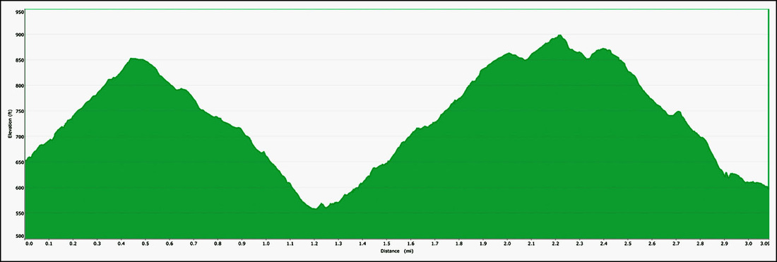
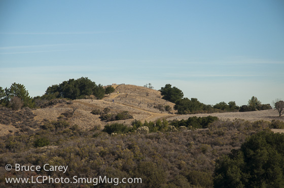
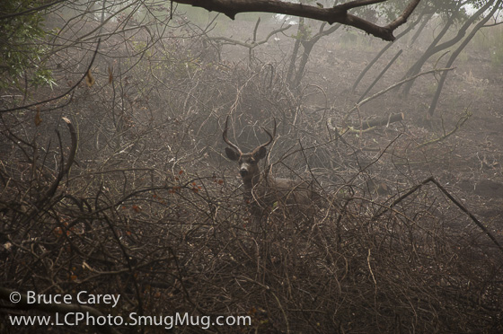
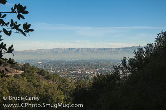
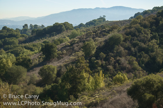
Opening Note: As of this initial writing I have only hiked this park in the Fall so I have no comments on Spring flowers. Hopefully I'll update this come spring. The hike starts with the ½ mile Cora Older trail, a medium width trail that immediately starts up a moderate incline. Through a series of switchbacks, the trail follows a ravine created by a creek of unknown name (dry in summer and fall). Most of the time is spent in stands of Oak that provide a shady place to walk. As you near the end of this trail the Oaks clear out and you enter the middle section of the park with its more open grasslands and patchy spots of Oak. The ascent continues in the open grasslands and after a short distance you enter the Seven Springs Loop Trail. This is a nice, mostly single track loop that descends to the lowest point of the hike with a fairly constant, moderate descent. The descent part of the trail travels through a dense, shady forest of several varieties of Oaks and Bayberries. In a few spots there is the pleasant surprise of ferns dotting the forest floor, a bit unusual at this low of an elevation. Further along on the trail some Maples begin to make an appearance and in the Fall their large yellow leaves make a good color show. Through the gaps in the trees can also be seen some early glimpses of the Silicon Valley around the Sunnyvale/Mountain View areas, a tantalizing preview of the more dramatic panoramas to come. The lowest elevation of the hike is fairly obvious as the trail levels for maybe 50 feet at the bottom of the ravine and immediately starts back up. This essentially follows one of my hiking caveats - "What goes down, must go up." At this point the forest cover opens up into more grasslands with patches of Oaks and even some EucalyptusThere are some occasional stretches through Oak forests . In the Fall there are some great dots of reds and oranges from some trees of a species unknown to me at present. As this section of trail is on the Valley side of the hills there are frequent views of the Valley. There are a few sections of fairly steep inclines in this section of the trail, but all are fairly short and alternate with more moderate climbs. There are several possible side trails you could take in this area. First is the Rainbow Knoll Trail and second is the Woodhills Loop. I have not yet explored these side trips so more on that when I do. Eventually the Seven Springs trail takes us back to the middle area of the park and merges with the Hayfield Trail. One final thought on the Seven Springs trail, I'm not really sure why it's called that as I have never seen any traces of even one spring, but I suppose there was some reason for the name at the time. Now on the Hayfield Trail, which at this point is a service road sized trail that follows the gently rolling, hilly contours of the land, you are back in the sunny, grassy, open middle section of the park. You'll go about a quarter of a mile and turn left onto a short connecting trail and then right at the next junction . You are now backtracking to the parking lot but since I prefer as much variety as possible in my hiking the only deviation from a straight "backtrack" is that rather than backtracking on the Cora Older Trail, I continue a little past that junction and take a left onto the Creekside Trail. It basically follows the same ravine as the Cora Older Trail but on the opposite bank. The trail mostly stays close to the deep cut of the creek and takes you through some nice Oaks, over a small wooden bridge and finally out onto Prospect Rd. A short jaunt down tree lined Prospect Rd. and you are back at the parking lot. Alternate Route Turn Points and Descriptions
|
Elevation Profile